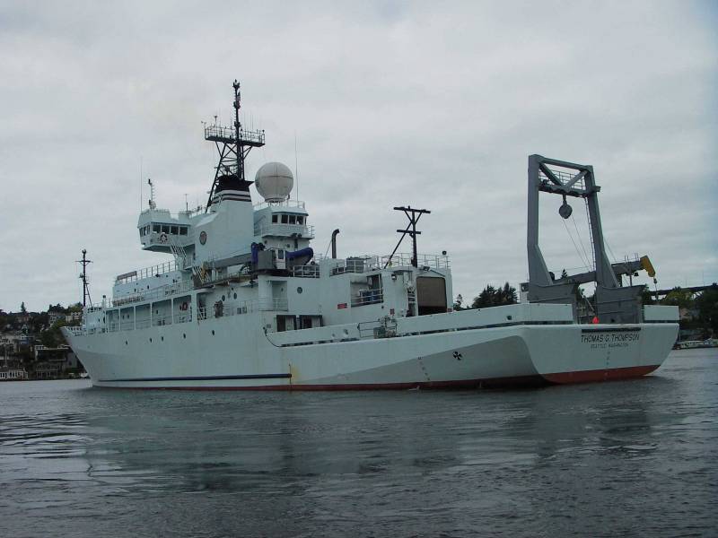
Chief Scientists: Chris Goldfinger and Chris Romsos (OSU)
Contents
Photos from the Cruise


Project Description
Rapid Proposal: Bathymetric Survey: Completion of Coverage of the Cascadia Subduction Zone in Support of the Cascadia Initiative OBS Array Deployment
Intellectual Merit: As part of the 2009 Stimulus or ARRA (American Recovery and Reinvestment Act) spending, NSF’s Earth Sciences (EAR) and Ocean Sciences (OCE) divisions each received $5M in facility-related investment. The funds were targeted toward the creation of an Amphibious Array Facility to support EarthScope and MARGINS science objectives. The initial emphasis and deployment site was onshore/offshore studies of the Cascadia margin, with an expectation that the facility would later move to other locations.
Addressing the offshore region, The Cascadia Initiative funded the construction of a total of 60 Ocean Bottom Seismometers (OBSs) by the three Institutional Instrument Contributors (IICs) of the National Ocean Bottom Seismometer Instrumentation Pool (OBSIP). The overall purpose if the deployment is the investigation of the Cascadia subduction margin and ridge system as a whole, a new approach embraced in recent years by EarthScope and OOI.
Good bathymetric data are essential for siting OBS station locations and ensuring the best chance of the instruments settling to the bottom in relatively smooth flat areas with a good chance of recording fidelity. Equally important is to deploy instruments in areas where the topographic, structural, and hydrologic context is reasonably well understood, so that a maximum number of instruments will be recovered from each deployment, and so that analysis of the signals will benefit from understanding the topographic and structural settings for each instrument. Some of the CI deployed instruments will be located on the abyssal plain of the Juan de Fuca plate, and are relatively safe from local geohazards. However, this initiative specifically addresses the Cascadia subduction boundary, and thus most of the instrument deployments are on the continental margin of this very dynamic plate boundary. Because many of the deployments are planned to span a number of active canyon systems and very seismically active areas, site selection will be difficult, and good bathymetric data are also required to prevent a number of instruments from being swept into channels and canyons and lost or damaged during the deployment. This proposal is aimed at remedying the poor bathymetric coverage in Cascadia, particularly along the Washington and Canadian margins for the safely of the instruments, and will also substantially improve our scientific context for future work in Cascadia expected under GeoPrisms and OOI.
Broader Impacts: Improvements in regional bathymetric coverage will significantly improve our understanding of the Cascadia subduction margin, and will have implications for seismic hazards in the western U.S. Additionally, the project will provide training and support for a graduate student who will develop structural models of the accretionary prism. The resulting data will be provided to the community through publications, national and international meetings, and public databases such as NGDC and PaCOOS without the normal 2 year moratorium.
Background and CIET Issues
NSF-OCE is funding a multibeam mapping cruise in support of the CI. Chris Goldfinger (OSU) and William Wilcock (UW) have been organizing this effort and Chris Ramsos (OSU) will be the Chief Scientist. The priorities of the effort are (1) to survey OBS drop sites for years 1-4 of the CI and as time permits (2) fill gaps in existing coverage along the margin (especially off Washington where coverage is presently limted).
There are several issues to discuss:
-
Timeline for delivery of existing multibeam data to the CIET for review.
-
Does the CIET want to review data prior to the mapping cruise? The objectives of this effort might be to
- Refine drop sites so as to take advantage of existing bathymetric coverage where possible
- Prioritize the mapping objectives
-
-
Mapping needs for OBS drop sites, for example
- Areal extent required for OBS drop sites in different settings (margin, mid-plate sedimented, areas with exposed basement)
- Areas where broader coverage is desirable to provide flexibility in network design
- Guidance to personnel on board the Thompson. Wilcock will likely not participate in the cruise, thus the mapping will be done by personnel without OBS experience. In this case we should give some guidance on what defines an acceptable drop site.
- Other issues?
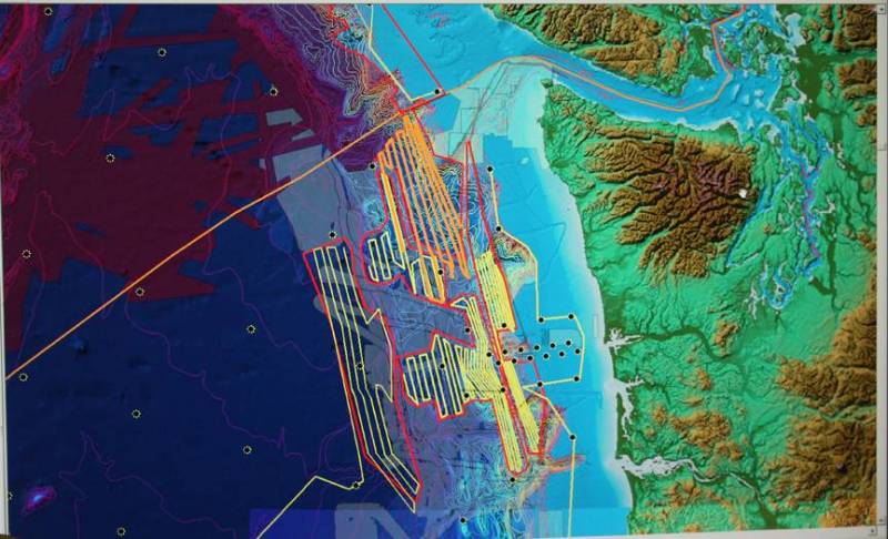
Here are some maps showing “existing coverage”.
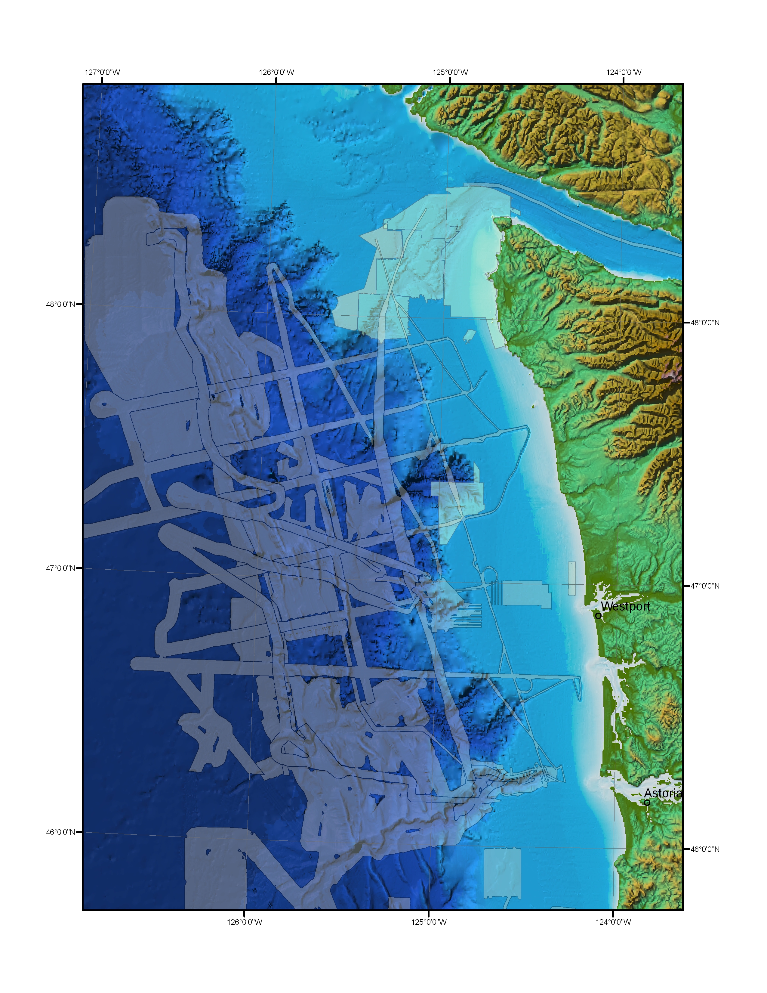
Areas covered off the WA coast provided by Chris Goldfinger
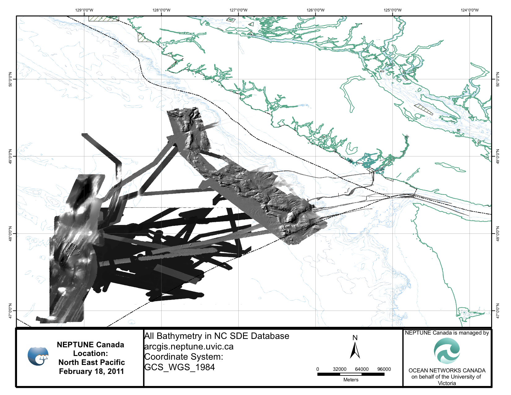
Areas covered in Canadian waters that are in the NEPTUNE Canada database (Mairi Best and Karen Douglas)<a title=”2011:bathymetryDatabase.jpg”
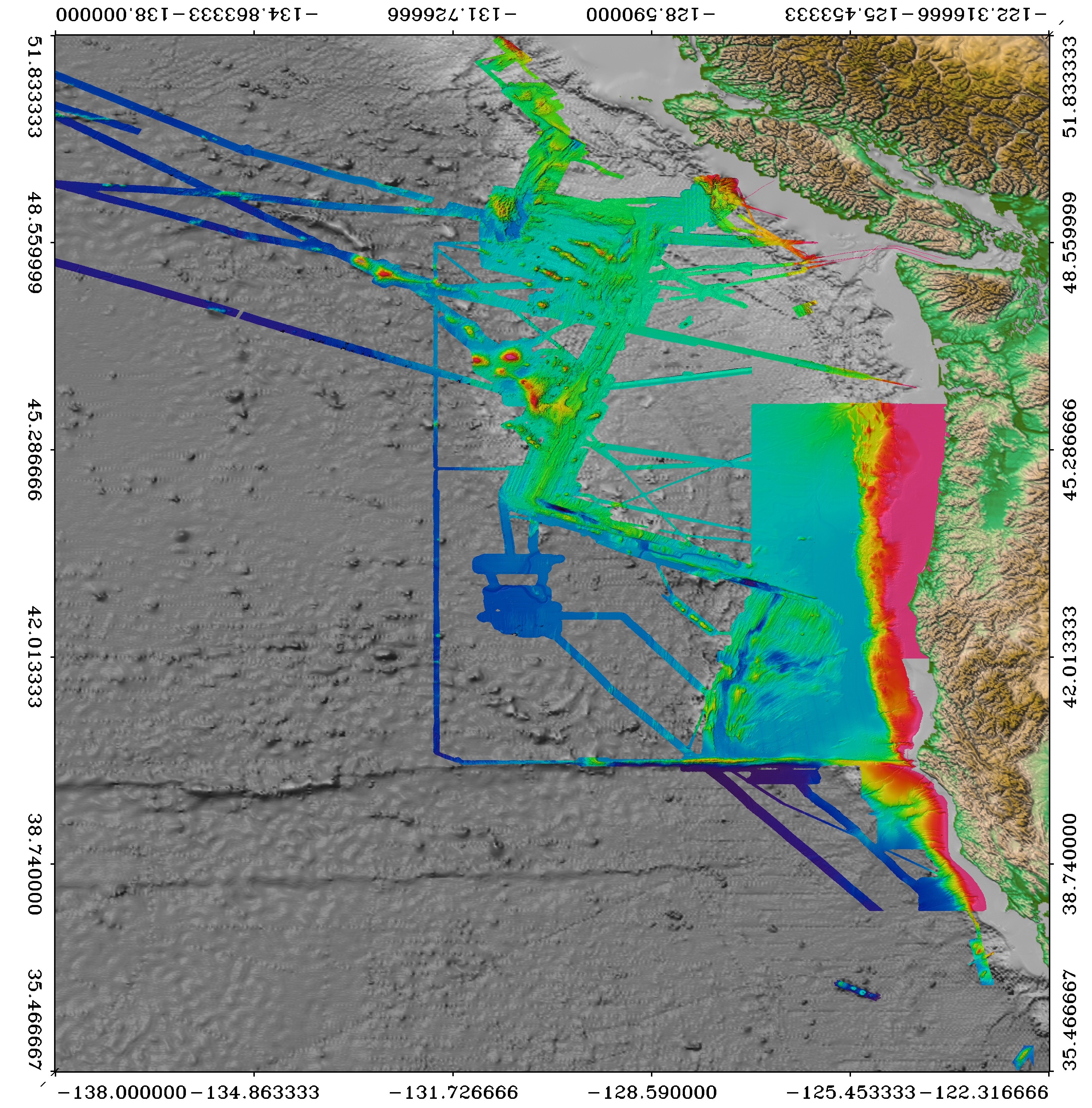
Areas covered on the Juan de Fuca from Deb Kelley and John Delaney. This is a jpeg of a 95 Mbyte tiff file and a 1.3 Gbyte fledermaus scene file which was generated by Larry Mayer for a proposal several years ago.
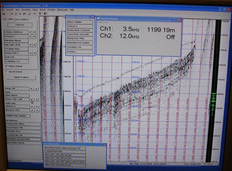
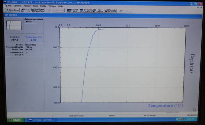
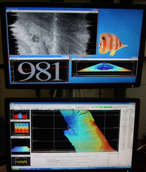
Comments on Thompson, Multibeam Mapping
Comments from site migration
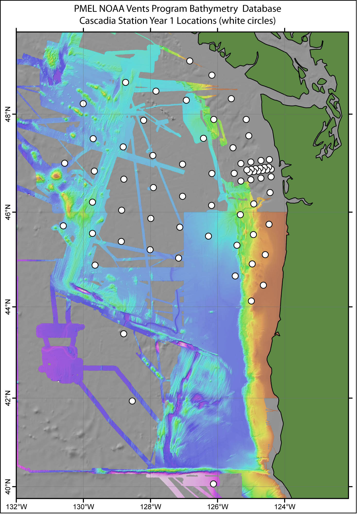
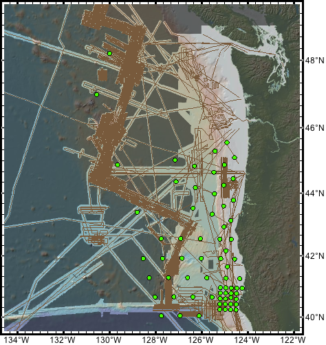
A couple of new maps showing bathymetry and year 1 stations
One below shows bathymetry in the NOAA/PMEL database (courtesy of Susan Merle and Bob Dziak). Compared to GeoMapApp and NGDC it includes better coverage on the Pacific plate west of the northern Juan de Fuca and a useful track hat is close to J28, J29 and J30. Susan will be adding this data to the NGDC database which will make it available in turn for GeoMapApp. Susan can also supply grids around specific sites.
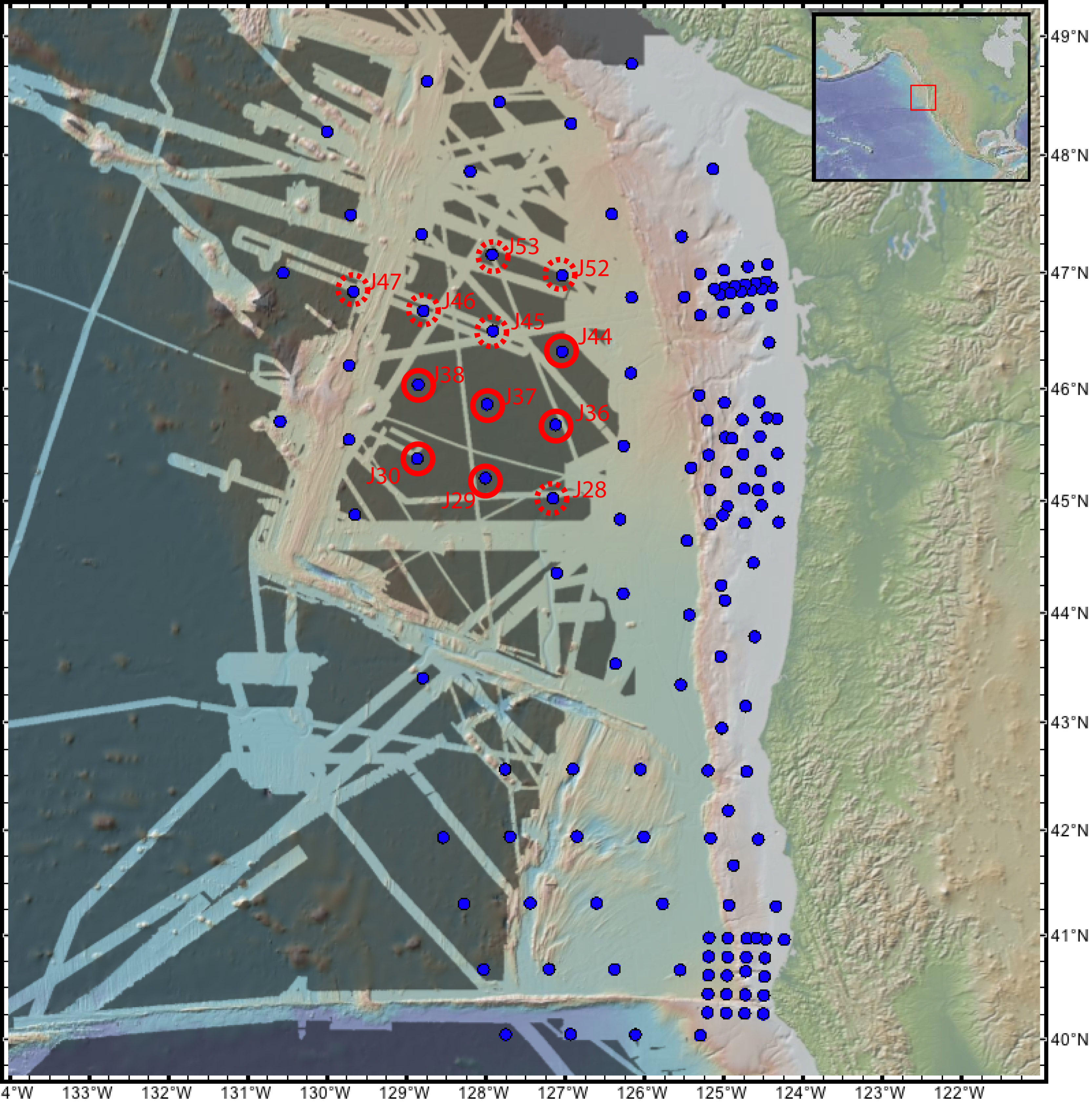
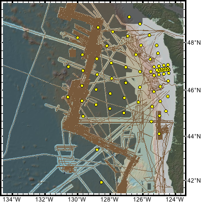
The other below shows coverage in the soon to be released version of geomapapp with 12 sites (6 higher priority with solid red circles and 6 lower priority with dashed red circles) that I am seeking to get mapped during transits to and from the Juan de Fuca Ridge this summer. At the time of writing the RSN (Deb Kelley and John Delaney) are looking into the feasibility of mapping J36, J37 and J38 from the R/V Thompson and Andy Fisher is looking into the feasibility of J52 and J53 from the R/V Atlantis. Bill Chadwick is on vacation but will look at the options for his R/V Atlantis cruise. J28, J29 and J30 may be the furthest form upcoming transits but luckily they are close to a an existing NOAA/PMEL (see map above).
Finally note that neither map is an accurate representation of multibeam coverage near the coast (the NOAA coastal relief map is based on soundings in some regions) but the Chris Goldfinger and Chris Romsos cruise is covering those site.
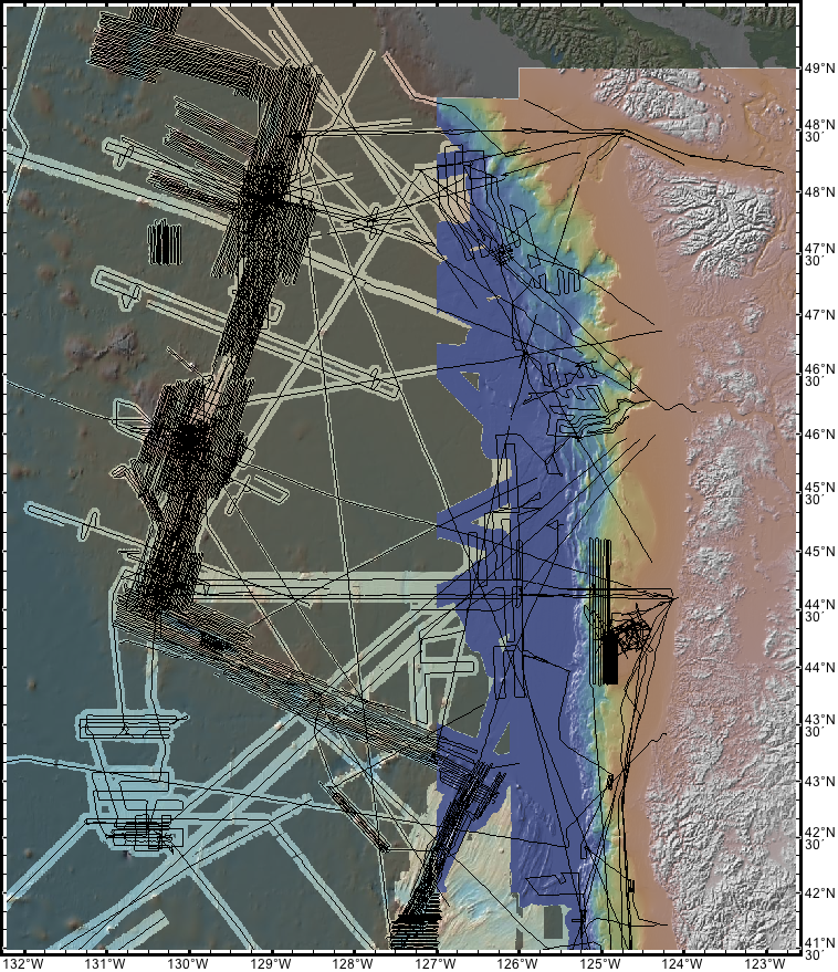
Chris Goldfinger and Chris Ramos are taking the lead on compiling bathymetry near the coast but I am looking offshore. Thanks to advice from Vicki Ferrini via Maya I have been using the NGDC bathymetry viewer (http://www.ngdc.noaa.gov/maps/bathymetry/) to compare what is in NGDC and GeoMapApp. The bottom line is that GeoMapApp is very incomplete
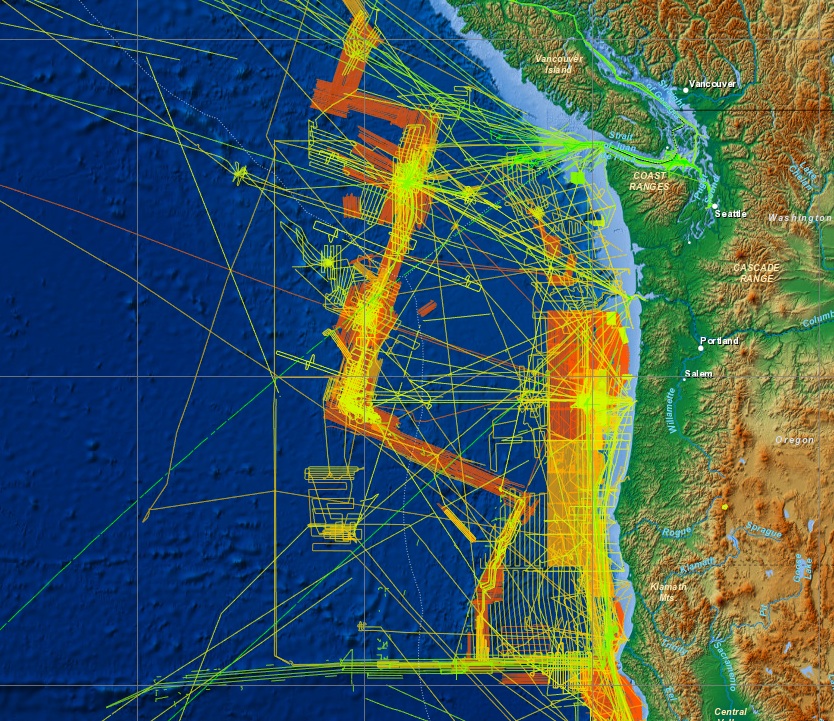
Here are are the tracks in GeoMapApp

Here are the tracks in NGDC
I have come up with a list of 50 cruises not in GeoMapApp(many just transits) that could potentially be of use in siting offshore OBS that are not currently included in GeoMapApp. Here is the excel spreadsheet
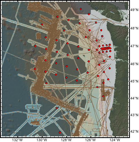
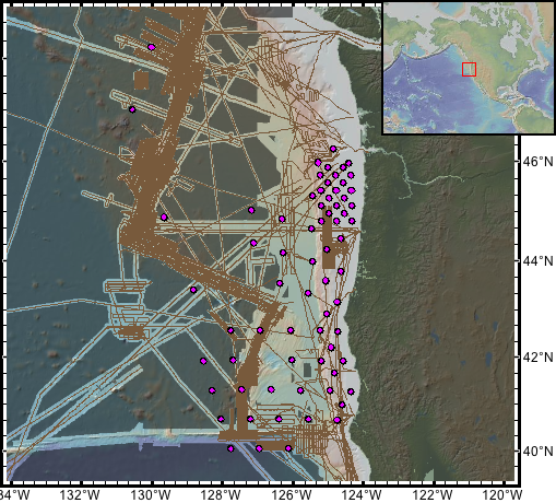
Here are track maps with the locations for each year. Whomever is planning each cruise probably needs to go into geomapapp and zoom in on each site individually to figure out coverage. But these might provide some general sense.
For the shallow water sites, final locations are likely to be more dependent on known hangs for trawlers so they might not be the priority for the mapping?
YEAR 1:
YEAR 2:
YEAR 3:
YEAR 4:
Attached a map created for us by Vicki Ferrini, showing the available bathy and tracklines with the NDGC coastal relief model in a different color scheme here. As per Chris Goldfinger, the coastal relief model is largely interpolation of single beam data points, with multibeam tracks incorporated where they exist. Unfortunately it’s not possible to remove this from the Geomapapp map because it’s integrated with the bathymetry. However, ship tracks give a reasonably idea of where that data is multibeam and where it isn’t.
Will,
Can you clarify if the coverage on the shelf shown in Larry Mayer’s compilation is accurate?
Question: Under Timeline for delivery it says:
“Does the CIET want to review data prior to the mapping cruise?”
Should this read “prior to the Leg 1 cruise”?
It reads correctly. The question is whether the CIET wants to review existing data prior to the mapping cruise in order to provide input on what is mapped.