Author Archives: asmet@uoregon.edu

Near the end of the cruise

Dean here, reporting in English,

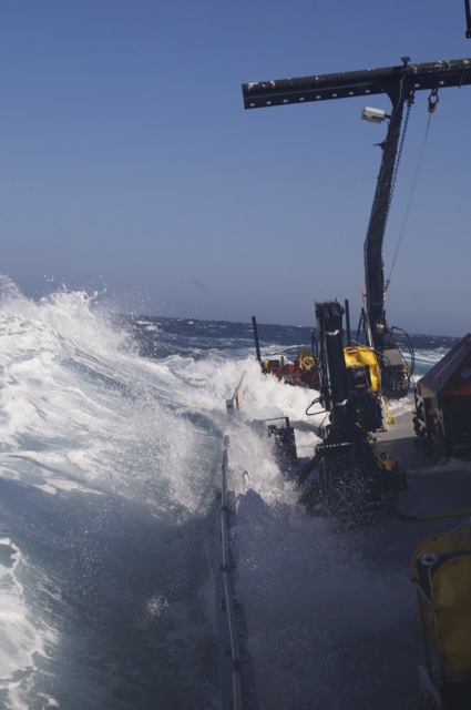
We’re sailing obliquely across the swells, bearing northeast towards the ‘hydrate ridge’ off of Oregon’s coast.  These past 3-4 days have been tough, an unusual weather pattern settled in with a low stuck over California and a high over the Pacific Northwest.  As a consquence, winds built out of the northwest to gale force, approaching 50 knots (that’s more than 50 miles per hour) and whipping the seas into a froth of confused waves riding growing swells.

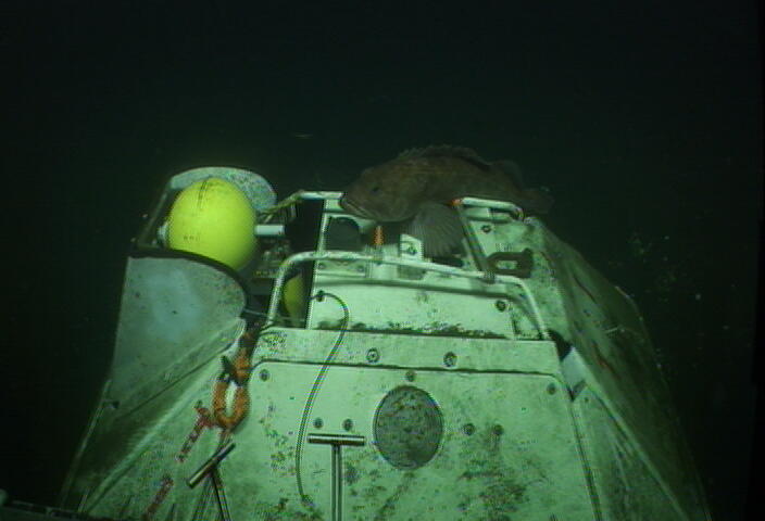
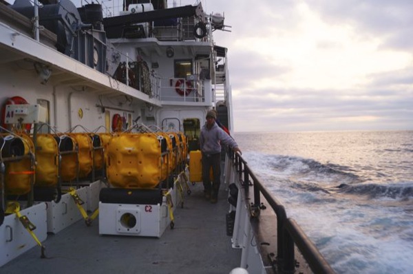
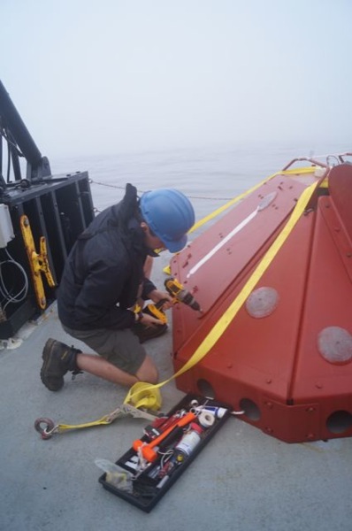
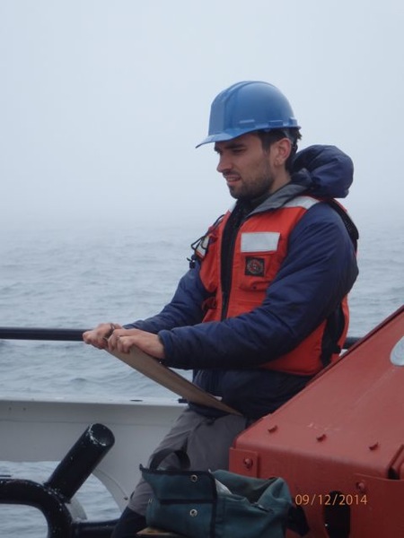
We had a spate of good luck early on, in that the rough weather we saw coming out of Astoria calmed down.  We left deep water ocean-bottom seismometers for later and focused on the ‘TRMs’ (trawl-resistant mount) OBSs that were recovered from shallower water.  Some of those involved Jason dives through spectacular sea life– a shark, squids, big ugly fish, thousands of brittle and sea stars, shrimp.  Jason dove to the rescue for one ‘pop-up’ TRM when its buoy, attached to line attached to the OBS, didn’t pop up.  So, just when our window of good weather was closing, we finished all but 3 of the 30 OBSs we sought to recover.

Then it became a game of cat and mouse with the growing, bad weather.  Mostly, we were the mouse.  We cruised north up the coast, sat on a site in rough seas where we couldn’t recover, then cruised north even more.  We had a bit of weather where we gathered in the final three deep-water OBSs, the kind that drop anchor and float to the surface on sonic command.

We then beat our way out through growing seas to the site of a lost OBS.  As with 2 cruises before us, we tried to communicate with that OBS (we do this with transponders that send sonic signals to it), but to no avail.  We set up in different positions around it in case it was sitting on its side, restricting the directions in which it could communicate.  The big problem was the weather, here we are in a ship equipped with Jason, and the seas were too rough for a dive.  We pulled out of that lost OBS site and travelled N, again beating against high seas, and did similarly with another lost OBS.  Again, many attempts from several positions and no communication.  And, again, weather and seas too rough to call in the Jason cavalry to the rescue.

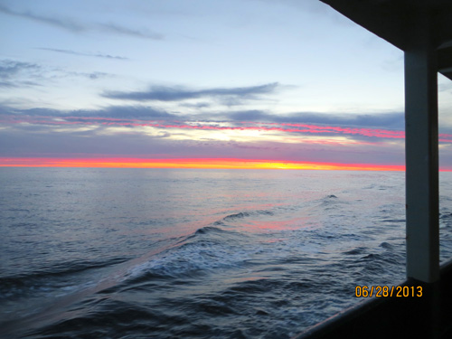
So here we are on our way back to port, via a ridge known for its gas bubbles.  We’ll sit on that overnight and use the ship’s sound-based bottom-mapping system (swath bathymetry) to instead image gas bubble plumes as they rise over the ridge.   We’ll pull off that site at about 3am and head back to the mouth of the Columbia.

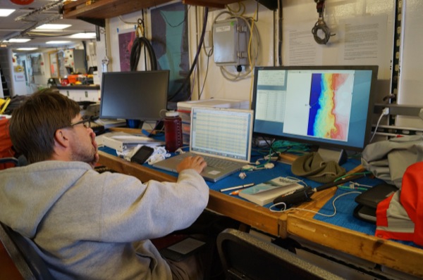
General impressions:  we made a few good calls early in the cruise regarding weather and where not to go next.  These combined with long days allowed us to collect the 20 OBSs in the ‘pop-up patch’ near Eureka, CA and Cape Mendocino, and important geological feature where the San Andreas Fault, the Mendocino Fracture Zone, and the Gorda plate spreading center all meet.  We pulled those up just in time.  Then we fought weather to finish the original 30 and try to recover the ‘lost boys’ further out to sea.  We imaged deep gas vents in various places.  We got to sit in the Jason control van and take pictures, make notes, otherwise bask in the cool geek glory.

We’re worn out but happy.  Year 3 of Cascadia is ready to transition from its third recover mission to its 3 deployment cruises later in the summer, where the ‘footprint’ of OBSs moves north to the coast of northern Oregon, Washington and BC.  Hooray!

Life at sea aboard Oceanus for the Cascadia Initiative– pre-cruise

Dean Livelybrooks (aka ‘Dr. D.’) reporting on 1-September, 2014.

We’re getting ready to start a 20 day cruise aboard the Oregon State University-operated  R/V Oceanus, departing from Newport, Oregon.  Our mission is to deploy 29 ocean-bottom seismometers (“OBS’s”) that will sit in dark solitude for the next year recording seismic signals and water pressure changes on the Juan de Fuca and Gorda tectonic plates offshore from the Pacific Northwest.  We are also charged with recovering 15 other OBSs that have done just that, so that data can be recovered and the instruments refurbished for their next mission.

We are sailing for the Cascadia Initiative Expedition Team (CIET)– a five-year program to monitor seismic, pressure and (land-based) GPS signals in Cascadia– a tectonically-active area encompassing oceanic plate creation at submarine ridges; subduction below the North American plate; infrequent, giant earthquakes;  semi-periodic ‘slow earthquakes’ that you can’t even feel; and volcano formation and eruptions in the Cascade Range– ergo the name.   We will be deploying or recovering 4 types of OBSs– all developed by Lamont-Doherty Earth Observatory (LDEO), though other CIET cruises deploy and recover OBS’s designed and operated by Woods Hole Oceanographic Institution and Scripps Institute of Oceanography.  Two of these types of OBS’s, along with the CIET-deployed ‘Abalones’ from Scripps, have been developed for the special conditions of shallow water deployment on the continental shelf, a first for marine seismology.  We call these “TRM’s” (for trawl-resistant mount) as they are designed to continue recording even when a fishing trawl net passes over them.   Here’s a picture of a TRM on the ocean bottom taken by ROV JASON during last season’s recovery cruise aboard Atlantis:

Well, I’ll sign off for now.  Look for more about the scientific objectives of CIET and impressions of life at sea from our crack team of Oceanus sailors, coming soon.       Dr. D.

First Days Onboard Oceanus

Hello World Wide Web!

I’m Magali, one of the five volunteers onboard the Oceanus, a 177 ft (54 m) research vessel owned by the National Science Foundation and operated by Oregon State University (OSU).

Figure 1: The Oceanus research vessel docked at Newport, Oregon.

On board the ship are four additional volunteers: Jeremy Schultz (UO), Brian Cook (OSU), Stephen Hicks (U. Liverpool), Alex De Moor (OSU), two chief scientists: Anne Tréhu (College of Earth, Ocean and Atmospheric Science, OSU) and Dean Livelybrooks (Department of Physics, UO), five scientists and engineers from Lamont-Doherty Observatory: Andrew Barclay, Carlos Becerril, John Clapp, Ted Koczynski, Walt Masterson, and the vessel’s crew. We embarked on a 20 day cruise from Newport, Oregon to deploy and recover ocean bottom seismometers (OBSs).

We are currently on our second day out at sea. So far we have deployed four of 29 ocean-bottom OBSs, two TRMs (FC03D, M12D) and two ARRAs (J26D, J18D) (Figure 2).

Figure 2: Map of deployment and recovery sites. The orange stars are TRMS, the red squares are ARRAs, the teal diamonds are pop-up TRMS, and the pink stars are recovery OBSs. We will be traveling from Newport, Oregon to Eureka, California and will loop back to Newport, Oregon.

TRMS, trawl-resistant mounts, are shallow water OBSs (the red instruments in figure 1) that use a metal shell to protect them from trawl and sea life while ARRAs (the smaller, yellow instruments in figure 1) are deep water OBSs that lack TRM’s metal shell. In addition to deploying OBSs, we also plan to recover 15 OBSs at a later time.

For my future blogs, instead of blogging about our daily activities, I’m going to blog about various aspects of our expedition.

Until the next entry,
Magali

What are the student volunteers’ typical responsibilities?

Hello World Wide Web!

The following blog summarizes our responsbilties as student volunteers onboard Oceanus.

Log deployments and recoveries

During our shift, our primary responsibility is to log time, latitude, longitude, and depth for various steps in either the deployment or recovery process (Figure 1). The log is stored digitally and hand written in case the electronic version is corrupted or lost.

Monitor shipboard instrument readouts

In the lab we have 8 screens that stream data as its collected by shipboard instruments. During our shift we keep a close eye on 2 displays, one displaying the 3 kHz and 12 kHz echo sounder readouts and the other displaying the captain’s navigation map. We monitor the former to ensure that we’re above the correct target depth, to notice any unexpected features on the ocean floor (Figure 2)), and to adjust the echo sounder’s phase and range controls as depth changes. We monitor the latter to make sure the ship’s current route plan matches the Science Team’s route to the next station. The navigation display also informs us of the the ship’s heading which we log for non-surveyed shallow deployments.

Figure 2: A screen shot of the 3 kHz echosounder’s readout. We think that the blob of dots extending from 80 to 110 m is potentially bubbles being ejected from an underwater vent.

Update the whiteboard with current and subsequent station information

We keep the white board in the main lab up to date with basic information for the current and subsequent station. The board shows the station name, the depth of the station, what type of OBS it is, and the expected time of arrival. The whiteboard informs the crew of the current station and what needs to be set up for the next deployment (Figure 3).

Assemble OBS

We help the crew move OBS components to where they’re needed for either assembly or deployment (Figure 4). We also help assemble OBSs by screwing in bolts and attaching brackets for the sensor and battery (Figure 5).

Review OBS checklist

Going through a detailed checklist after an OBS is assembled assures that all components are secure and functioning before deployment (Figures 6 & 7).

OLYMPUS DIGITAL CAMERA

Communicate with the OBS during deployment

After an OBS touches the surface of the ocean and goes into freefall, its depth is monitored by pinging either its external or internal transponder. Once we confirm the OBS has hit the ocean floor, we send it a command to learn whether its sitting upright. If the OBS is sitting upright, we input a release code that detaches the winch from the OBS. The final step during the deployment process is to disable the transponder to preserve its battery life (Figure 8).

Awaken the crew members at the times requested.

Since the crew members have scattered working hours, to help them rest, we awaken them at a requested time before our estimated arrival at a site.

Monitor the lab for any safety hazards.

The lab contains many batteries that can catch on fire. Furthermore, ocean swells can cause the ship to move violently, moving objects that are not secured to a surface. Our shifts are scheduled so that at least one student is awake at any time to notice and respond to emergencies.

Rough Waters

Hello World Wide Web,

On day four of our expedition, the Oceanus encountered three to four foot swells coming from two different directions. These waves constructively interfered in such a way that they became up to seven foot swells! As the ship rocked violently, any non-secured object flew from its resting area. We even had to tie down our chairs to channel iron so they wouldn’t tip over. Unfortunately, some of the ARRA deep-water OBSs were damaged. Although repairing them temporarily delayed our schedule, we were relieved to know that the OBSs were still deployable. Since day four, the sea has been relatively calm but we might encounter turbulent waters as the week ends.

– Magali